Sightseeing Information
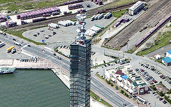
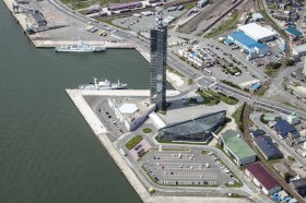
Port Tower SELION
Covered with glass, the Port Tower is a characteristic landmark in the Port of Akita and its term of endearment is "Selion." The tower is 143 m in height and provides panoramic view from the observation deck floor of 100 m high, and there you can look down the Sea of Japan and the urban area of Akita City and overlook the Oga Peninsula, Mt. Taihei, and the unparalleled beauty of Mt. Chokai. From the morning to twilight and night, you can enjoy Akita's varied scenery full of expression.
- Address
- 011-0945
1-9-1, Tuchizakiminatonishi, Akitashi, Akita - Access
- 10 minutes on foot
- Distance
- 800m
- Links
-
Port Tower SELION
- Contact
-
Tourism Promotion Division
TEL +81-18-860-2261
Uchikura of Masuda
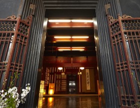
The uchigura storehouses of the Masuda area in Yokote City were selected as an Important Preservation District for Groups of Traditional Buildings. The uchigura is at the rear of the main building, and the earthen storehouses are covered by the roof, so the uchigura cannot be seen from the main street. Unlike other earthen storehouses, these distinctive buildings have living areas.
- Address
- 019-0701
5, Motomachi, Masuda, Masudamachi, Yokote-shi, Akita - Access
- 100 minutes
- Distance
- 92km
- Links
-
Uchikura of Masuda
Masuda Tourism Association - Contact
-
Tourism Promotion Division
TEL +81-18-860-2261
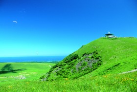
Mt.Kampu Rotating Obserbation deck
Mt. Kampu, reaching a height of 355 m, is a gentle slope mainly covered with grass. The rotating observation deck at the summit commands a panoramic view of land reclaimed from Hachirogata to the east, once Japan's second largest lake; Mt. Chokai to the south; Nyudozaki Cape to the west; and World Heritage Site Shirakami-Sanchi to the north. All this can even be enjoyed while dining.
- Address
- 010-0344
62-1, Kampuzan, Wakimoto Tominaga, Oga-shi, Akita - Access
- 34 minutes by car
- Distance
- 13.5km
- Links
-
Mt.Kampu Rotating Obserbation deck
- Contact
-
Akita prefecture,Tourism Promotion Division
TEL +81-18-860-2261
Kakunodate Samurai Residences
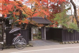
Kakunodate is an area where thick copses of trees and massive residences still stand as reminders of Japan's feudal times. Being called the Little Kyoto of northeastern Japan, it is famous for the cherry blossom trees that decorate the entire town. The Bukeyashikidori Street, or the area commonly known to stretch from National Route 46 at the foothills of Mt. Furushiro to just before the firebreak, was selected as an Important Preservation District for Groups of Traditional Buildings in September 1976.
- Address
- 014-0331
1, Simotyo, Omote-mathi, Kakunodate-mathi, Senboku-shi, Akita - Access
- 110 minutes
- Distance
- 67km
- Links
-
STAY AKITA,Kakunodate Samurai Residences
- Contact
-
Tourism Promotion Division
TEL +81-18-860-2261
NamahageMuseum,OgaShinzan Folklore Museum
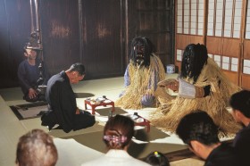
The NamahageMuseum exhibits valuable documents related to Oga's Namahage ogres based in folklore and known across Japan, and showcases a dynamic display of 150 diverse Namahage masks actually used across the city. The adjacent OgaShinzan Folklore Museum replicates the New Year's Eve ritual involving these Namahage.
- Address
- 010-0685
Mizukuisawatinai, Kitaura Shinzan, Oga-shi, Akita - Access
- 27 minutes by car
- Distance
- 16.1km
- Links
-
Experience the folklore of the Namahage Namahage Museum
- Contact
-
NamahageMuseum
TEL +81-185-22-5050
Shirakami-Sanchi World Natural Heritage Site
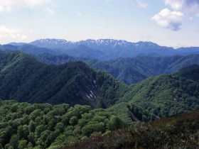
Shirakami-sanchi is a moountainous region that has elevations ranging from 200 m to 1,250 m and straddles the prefectural border between the southwestern part of Aomori Prefecture and the northwestern part of Akita Prefecture. The World Natural Heritage property is an area of approximately 17,000 ha situated in the central part of Shirakami-Sanchi. It is an almost undisturbed pristine beech forest,as it is located in the steep-sided hills far away from cities.
- Access
- Bus two hours
mountain climbing one hour 31 minutes - Distance
- 65km
- Links
-
The Shirakami-Sanchi World Heritage Conservation Center
- Contact
-
Akita prefecture,Tourism Promotion Division
TEL +81-18-860-2261


